By Advent Shoko
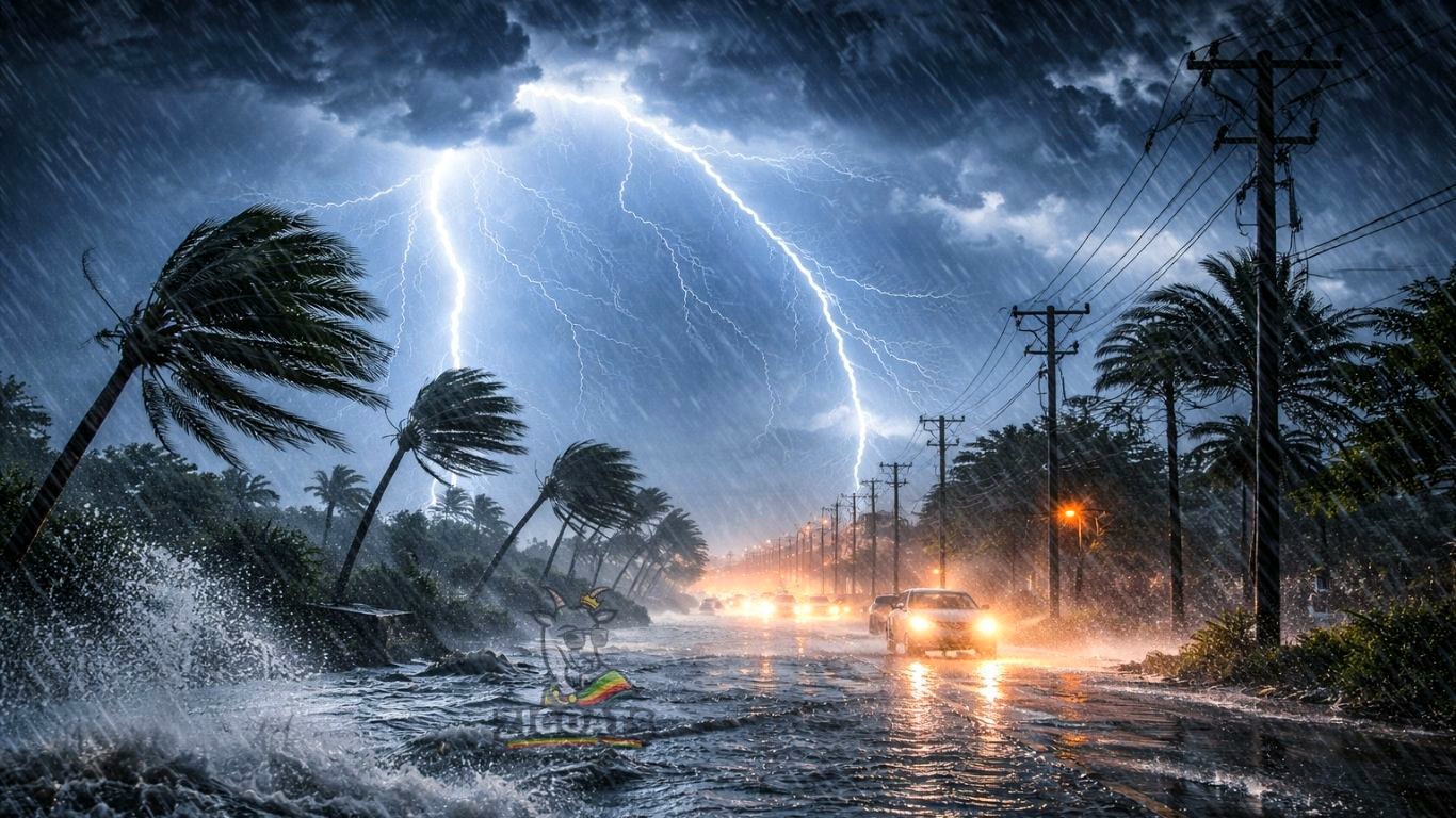
The latest weather report and forecast shows that Zimbabwe is in for a wet, stormy and potentially dangerous weather weekend as the Meteorological Services Department (MSD) warns of scattered thunderstorms with localised heavy rainfall, lightning and possible flooding across large parts of the country.
According to the latest Weather Report and Forecast, intense convective activity was already recorded across large parts of Zimbabwe on Saturday 17 January 2026, particularly over Manicaland and Masvingo provinces, setting the tone for an active and unstable weather pattern heading into Sunday and Monday.
What Happened On Saturday
Satellite-based observations seen by ZiGoats show that scattered thunderstorms affected most parts of Zimbabwe, driven by high moisture levels in the atmosphere.
The highest recorded rainfall amounts were:
- Beitbridge – 49mm
- Odzi (Mutare district) – 95mm
- Zvishavane – 41mm
- Zaka – 31mm
- Bikita – 27mm
Most remaining areas recorded below 27mm, but cloud cover remained widespread, with mostly cloudy and mild conditions in the morning, followed by rising temperatures and thunderstorm development in the afternoon.
SUNDAY 18 JANUARY 2026: Heavy Rainfall Warning
For Sunday, the MSD forecasts mostly cloudy and mild morning conditions, with light rain and showers in some areas.
As the day progresses, conditions are expected to turn cloudy and warm, triggering scattered thunderstorms. Of particular concern is localised heavy rainfall exceeding 50mm, which is probable in Mashonaland East and the northern parts of Manicaland.
These rainfall levels significantly increase the risk of:
- Flash flooding
- Rivers bursting their banks
- Washed-away bridges and roads
- Lightning-related incidents
MONDAY 19 JANUARY 2026: Wet Weather Conditions Persist
The unstable weather pattern continues into Monday, with:
- Mostly cloudy and mild mornings
- Warm afternoons
- Scattered thunderstorms across all areas
Heavy rainfall is probable in Matabeleland North, Mashonaland West, the Midlands and northern Manicaland, extending the flood risk into new regions.
CITY-BY-CITY OUTLOOK: Sunday To Thursday
The MSD’s Main Cities Forecast (18–22 January) paints a consistently wet picture nationwide:
Harare: Persistent rain daily, with rainfall peaking midweek (up to 19.5mm on Wednesday). Daytime temperatures around 19–22°C.
Mutare: Very wet conditions, including 31.9mm on Sunday and 48.6mm on Wednesday, confirming Manicaland as a rainfall hotspot.
Marondera: Significant rainfall expected midweek, especially 74.4mm on Wednesday, raising serious flood concerns.
Kwekwe: Heavy rain forecast, peaking at 73.2mm on Thursday.
Gweru: Increasing rainfall towards midweek, with 32.6mm expected on Thursday.
Bulawayo: Cooler and wet, with rainfall intensifying from Wednesday onwards (28mm on Wednesday, 27.6mm on Thursday).
Masvingo: Regular showers throughout the period, maintaining saturated ground conditions.
Kadoma, Chinhoyi, Bindura, Lupane and Gwanda: All expected to experience repeated rainfall episodes, with intermittent sunshine but no prolonged dry spells.
- Bananas Key To Attainment Of Zimbabwe’s US$2 Billion Horticulture Vision
- Illegal Cigarettes Force BAT South Africa Plant Closure As Zimbabwe-linked Rivals Rise
- Tanganda Tea Company Appoint Sharon Kodzanai As CEO
What This Means For Farmers And Communities
From an agriculture perspective, the rains are largely beneficial for crops, pastures and water reservoirs, particularly for maize and small grains now in their critical growth stages.
However, excessive rainfall in a short period poses risks of:
- Waterlogging of crops
- Soil erosion
- Nutrient leaching
- Livestock losses due to flooding
Farmers are advised to monitor drainage, secure livestock in higher ground, and avoid working in open fields during thunderstorms.
PUBLIC SAFETY ADVISORY
🚨 The Meteorological Services Department strongly advises:
Avoid crossing flooded rivers, even if water appears shallow.
- Seek shelter in a safe building or hard-topped vehicle during thunderstorms.
- Do not shelter under trees or near metal objects during lightning activity.
- Delay outdoor activities until storms have passed.
- ⚡ When thunder roars, go indoors. Lightning can strike several kilometres away from a storm.
The Bottom Line
The latest Zimbabwe weather forecast notes that the country is entering a high-impact rainfall phase, with scattered thunderstorms, heavy downpours and lightning expected to persist through the weekend and into the new week.
While the rains are a lifeline for agriculture and water security, they also demand heightened caution from the public, especially in flood-prone areas.
Stay weather-aware. Stay safe.
Leave a Reply